By Admin. Updated 6:13 a.m., Sunday, June 30, 2024, Atlantic Standard Time (GMT-4).
On its present forecast track, the centre of Hurricane Beryl is expected to pass near or over St. Vincent and the Grenadines (SVG) during Monday morning, the SVG Met Office said.
Advisory Number 4 issued by the St. Vincent and the Grenadines Meteorological Services (SVG Met Office) on Sunday, stated that a hurricane warning remains in effect for Saint Vincent and the Grenadines (SVG).
A Hurricane Warning means that hurricane conditions are expected across SVG within 36 hours.

The Advisory stated that:
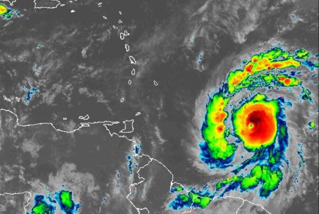
At 5 am, Hurricane Beryl was located near latitude 10.7° North; longitude 53.1° West, or approximately 570 miles (917 kilometers) east of the SVG. “Beryl” is moving toward the West at 21 mph (33 km/h), and on its present forecast track, the center of the system is expected to pass near or over SVG during Monday moming. Maximum sustained winds are 100 mph (160 km/h). Minimum Central Pressure is 981 mb or 28.87 inches.
Hurricane force winds extend outward up to 15 miles (30 km) from the center, and tropical storm force winds extend outward up to 60 miles (95km). Storm force winds are possible across SVG from late night.
Rapid strengthening is forecast over the next day or so, and Beryl is expected to become an extremely dangerous hurricane before it reaches the Windward Islands. All preparations to protect life and property should be rushed to completion.

According to the Advisory, here are some possible impacts:
Maximum sustained winds of 100 – 132 mph (160 – 212 km/h) are expected from early Monday.
Rainfall accumulations of 4 to 6 inches (100 to 150mm are likely across St. Vincent and the Grenadines. A flash-flood Warning will be in effect from 6 pm, today Sunday 30th June*, 2024.
Marine conditions are expected to be very rough and hazardous with sea-swells exceeding 4.0m (13ft) and possibly higher ~8.0m (26ft), near the center of ‘Beryl’ during Monday. Large and destructive waves/swells are likely to cause life-threatening surf and rip currents. These will create unsafe conditions for small-craft operators and fishermen. A High-Surf Advisory and Small-Craft Warning will be in effect from 12 noon, today Sunday 30th July, 2024. Small craft operators are advised to remain in port. Please secure all vessels and other equipment. Sea-bathers and other users of the sea are advised to stay out of the water.
Another disturbance is located over the Eastern Atlantic, with a 70% chance of development, and a depression is likely as it tracks near our area by Wednesday. Be Prepared!!