

By Admin. Updated 6:49 a.m., Monday, July 1, 2024, Atlantic Standard Time (GMT-4).
The St. Vincent and the Grenadines Meteorological Services (SVG Met Office) says a hurricane warning remains in effect for Saint Vincent and the Grenadines (SVG).
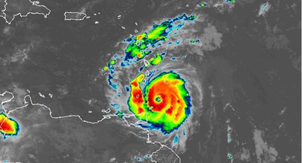
In Advisory 11 issued at 5:00 a.m., the Met Office says that at 5 am, Hurricane Beryl was located near latitude 11.7° North; longitude 59.9 West, or approximately 140 miles (225 kilometers) east southeast of SVG. Hurricane Beryl is moving toward the west at 20 mph (31 km/h) with maximum sustained winds of 120 mph (195 km/h).
Minimum Central Pressure is 965mb or 28.50 inches. Hurricane-force winds extend outward up to 35 miles (55 km) from the center, and tropical storm-force winds extend outward up to 125 miles (205km). All preparations to protect life and property should be completed.
The Met Office says the following are the possible impacts:
Maximum sustained winds of 120 mph (195 km/h) are expected from early Monday.
Rainfall accumulations of 4 to 6 inches (100 to 150mm) are likely across St. Vincent and the Grenadines.
A flash flood Warning remains in effect.
Marine conditions are expected to be very rough and hazardous with sea swells exceeding 4.0m (13ft) and possibly higher -8.0m (26ft), near the center of ‘Beryl’ on Monday. Large and destructive waves/swells are likely to cause life-threatening surf and rip currents. These will create unsafe conditions for small-craft operators and fishermen.
High-Surf Warning and Small-Craft Warnings remain in effect.
Small craft operators are advised to remain in port. Sea-bathers and other users of the sea are advised to stay out of the water.
Another disturbance is located over the Eastern Atlantic, with a 70% chance of development, and a depression is likely as it tracks near our area by Wednesday. Be Prepared!!
