By Admin. Updated 12:57 a.m., Monday, July 1, 2024, Atlantic Standard Time (GMT-4).
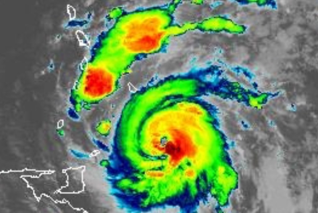
Just as the meteorologists predicted, St. Vincent and the Grenadines (SVG) has begun experiencing stormy conditions as Category 4 Hurricane Beryl moves into the area.
Heavy wind, thunder and lightning, rain, and electricity outages are already being experienced.
The real impacts of the hurricane, however, are expected to be felt at around 8:00 a.m. this morning (July 1).

In an 11:00 p.m. Advisory on June 30, the St. Vincent and the Grenadines Meteorological Services said the following:
A hurricane warning means that hurricane conditions are expected across SVG, in this case, within 12 hours.
At 11 pm, Hurricane Beryl was located near latitude 11.5* north; and longitude 58.1* west, or approximately 245 miles (390 kilometers) east-southeast of SVG. Hurricane Beryl is moving toward the west at 20mph (31km/h) with maximum sustained winds of 130mph (215 km/h).
Minimum Central Pressure is 958mb or 28.29 inches. Hurricane force winds extend outward up to 30 miles (45 km) from the center, and tropical storm force winds extend outward up to 115 miles (185km). All preparations to protect life and property should be completed.
Possible Impacts:
Storm-force winds are likely from (Sunday) 39 -73 mph (68 – 118 mph).
Maximum sustained winds of 130 mph (215 km/h) are expected from early Monday.
Rainfall accumulations of 4 to 6 inches (100 to 150mm) are likely across St. Vincent and the Grenadines. A flash-flood Warning came remains in effect.
Marine conditions are expected to be very rough and hazardous with sea swells exceeding 4.0m (13ft) and possibly higher -8.0m (26ft), near the center of ‘Beryl’ on Monday. Large and destructive waves/swells are likely to cause life-threatening surf and rip currents. These will create unsafe conditions for small-craft operators and fishermen.
A High-Surf Warning and Small-Craft Waning remains in effect.
Small craft operators are advised to remain in port. Sea-bathers and other users of the sea are advised to stay out of the water.
Another disturbance is located over the Eastern Atlantic, with a 70% chance of development, and a depression is likely as it tracks near our area by Wednesday. Be Prepared!!