


By Admin. Updated 2:38 p.m., Tuesday, July 22, 2025, Atlantic Standard Time (GMT-4).
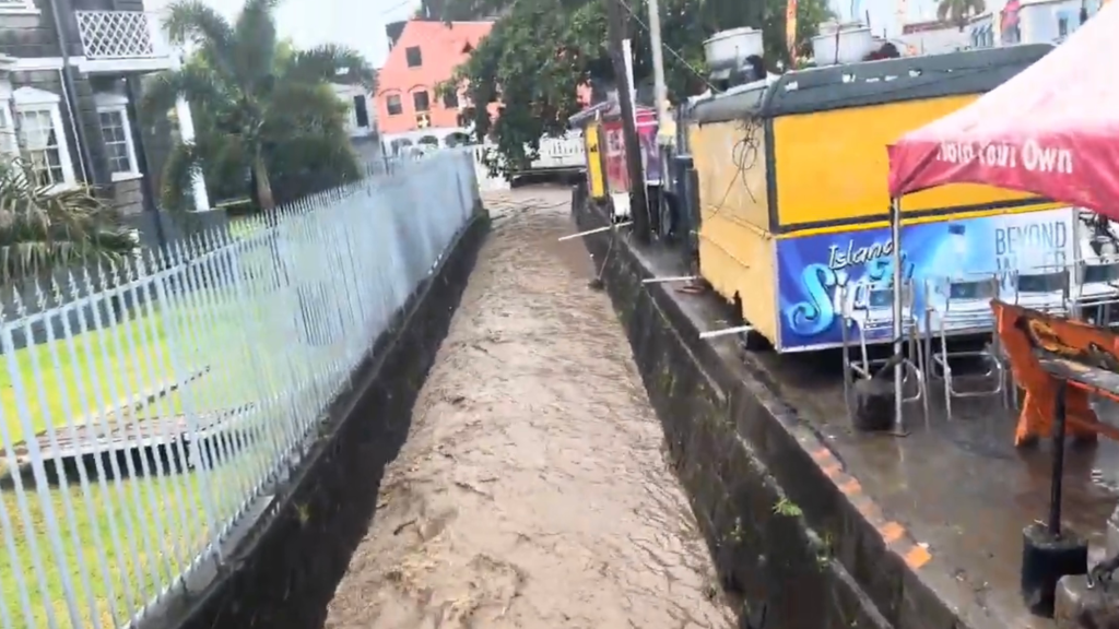
The St. Vincent and the Grenadines Meteorological Services (SVG Met Office) announced at 2:00 p.m. on Tuesday that a Flash Flood Watch is in effect for the country.
A Flood-Watch is issued when conditions are favourable and there exists the possibility of flooding during the watch period.
In an Advisory, the Met Office said a tropical wave is affecting our islands and deteriorating weather conditions are anticipated across St. Vincent & the Grenadines within the next 12 to 36 hours.
Showers of various intensities (light to heavy) can be expected as moisture levels elevate across our islands. Periods of light rain and isolated thunderstorms are also anticipated across St Vincent and the Grenadines within the forecast period.
In addition, rainfall accumulations of 50-100mm (approximately 2-4 inches) with isolated higher amounts in mountainous areas are also possible, the Met Office said.
At the AIA station, there has already been in excess of an inch (>25mm) of rainfall within the last 24 hours and it is highly likely that additional showers will continue. As a result, the weather advisory that was already in effect for a low risk of flooding has now been upgraded to a flash flood watch and will remain in effect until further notice, the Met Office further stated.
Residents and motorists in areas prone to flooding and landslides or near rivers and streams should be prepared
This flash-flood watch may be upgraded to a warning if conditions warrant.
END


