By Admin. Updated 10:23 p.m., Saturday, August 23, 2025, Atlantic Standard Time (GMT-4).
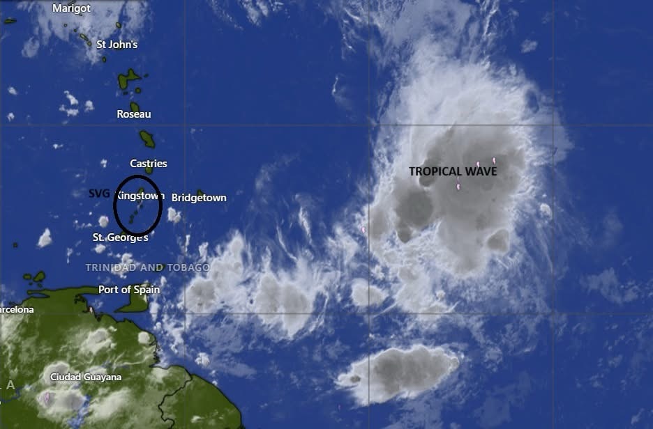
Meteorologists are monitoring a tropical wave in the Atlantic Ocean which they say could strengthen into a tropical depression during the next day or two.
The St. Vincent and the Grenadines Meteorological Services said, in a Saturday, August 23, publication that it continues to monitor the “strong tropical wave located 500 miles (805 km) to the east of the Windward Islands.”
“Showers and thunderstorms have increased and are beginning to show signs of organization. This system could become a tropical depression during the next day or two while it moves quickly westward at about 20 to 25 mph, passing through the Windward and Leeward Islands late Sunday,” the SVG Met Office said.
Current model guidance suggests that there is medium chance (40% of development during the next seven (7) days.
“Regardless of development, this system is likely to generate cloudy skies and trigger moderate to heavy showers and thunderstorms across St Vincent and the Grenadines by late Sunday. In addition, strong wind speeds ahead of this system are also forecast which would result in deteriorating sea conditions,” the Met Office said.
Here is the rest of the report.
The system is expected to reach the central Caribbean on Tuesday 26 August 2025, where conditions are expected to become less favorable for additional development. An Air Force reconnaissance aircraft is scheduled to investigate the system tomorrow, if necessary.
Flash flood watches or warnings may be issued within the next 24 hours.
Residents are advised to keep informed on the progress of this system.
For information being issued by the St. Vincent and the Grenadines Meteorological Services visit, http://www.meteo.gov.vc/or follow us on Facebook via, https://facebook.com/svgweather
This information statement is intended for preparedness purposes.
END
