
…ELSA STRENGTHENS INTO A HURRICANE…
…HURRICANE CONDITIONS SPREADING THROUGH THE WINDWARD ISLANDS…
- A Hurricane Warning is in effect for Barbados, St. Lucia, St. Vincent and the Grenadines. Hurricane conditions are occurring on Barbados, and are expected in the hurricane warning area in the Windward Islands in the next few hours.
- A Tropical Storm Warning is in effect for Martinique, the southern coast of Dominican Republic from Cabo Engano to the border with Haiti, and the entire coast of Haiti. Tropical storm conditions are expected in portions of the Windward and southern Leeward Islands within the tropical storm warning areas and are possible in the tropical storm watch areas later today. Tropical storm conditions are expected in the warning areas in the Dominican Republic and Haiti on Saturday, with hurricane conditions possible in southern Haiti.
- A Hurricane Watch is in effect for the southern portion of Haiti from Port Au Prince to the southern border with the Dominican Republic.
- A Tropical Storm Watch is in effect for Grenada and its dependencies; Saba and Sint Eustatius; Jamaica and Dominica. Tropical storm conditions are possible in Jamaica Saturday night or early Sunday.
Interests elsewhere in the Windward Islands, Leeward Islands, then Virgin Islands, Puerto Rico, the Dominican Republic, and Cuba should monitor the progress of Elsa. Additional watches and warnings will likely be required later today, including Hurricane Warnings for portions of Haiti and the Dominican Republic.
There is a risk of storm surge, wind, and rainfall impacts in the Florida Keys and portions of the Florida Peninsula early next week. However, the forecast uncertainty remains larger than usual due to Elsa’s potential interaction with the Greater Antilles this weekend.
Interests in Florida should monitor Elsa’s progress and updates to the forecast.
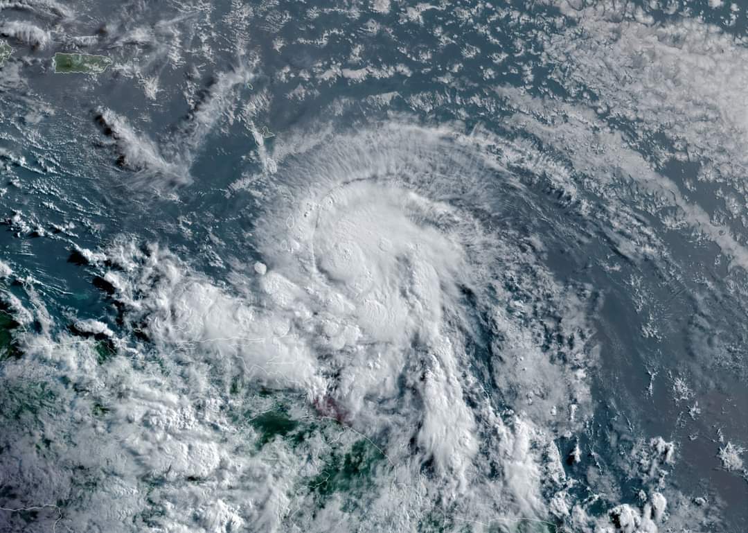
At 8:30 a.m. AST, the center of now Hurricane Elsa was located about 40 miles (65 km) west of Barbados. It’s moving toward the west-northwest near 28 mph (44 km/h), and this motion is expected to continue during the next couple of days. On the forecast track, Elsa will pass near or over portions of the Windward Islands or the southern Leeward Islands this morning, move across the eastern Caribbean Sea late today and tonight, and move near the southern coast of Hispaniola on Saturday. By Sunday, Elsa is forecast to move near Jamaica and portions of eastern Cuba.
Reports from Barbados indicate that maximum sustained winds have increased to near 75 mph (120 km/h) with higher gusts. Hurricane-force winds extend outward up to 25 miles (35 km) from the center and tropical-storm-force winds extend outward up to 140 miles (220 km). Barbados recently reported sustained winds of 74 mph (119 km/h) and a wind gust of 86 mph (138 km/h). Little change in strength is forecast to occur during the next 48 hours.
A storm surge will raise water levels by as much as 1 to 3 feet above normal tide levels in areas of onshore winds in the hurricane warning area in the Windward Islands and along the southern coast of Hispaniola.
Elsa is expected to produce rainfall totals of 3 to 6 inches with maximum amounts of 10 inches today across the Windward and southern Leeward Islands, including Barbados. This rain may lead to isolated flash flooding and mudslides. Over Puerto Rico, rainfall of 1 to 3 inches with localized amounts of 5 inches is expected late today into Saturday. This rain may lead to isolated flash flooding and minor river flooding, along with the potential for mudslides. Across portions of southern Hispaniola and Jamaica, rainfall of 4 to 8 inches with isolated maximum amounts of 12 inches is possible Saturday into Sunday. This rain may lead to scattered flash flooding and mudslides.
The next complete advisory will be issued at 11 a.m. AST – http://www.hurricanes.gov
