
From the Miami-based National Hurricane Center
…ELSA STILL MOVING RAPIDLY WEST-NORTHWESTWARD…
…TROPICAL STORM WATCH ISSUED FOR PORTIONS OF HAITI…
- A Tropical Storm Warning is in effect for Barbados, Martinique, St. Lucia, St. Vincent and the Grenadines. Tropical storm conditions are expected in portions of the Windward and southern Leeward Islands within the warning areas on Friday.
*A Tropical Storm Watch is in effect for Grenada and its dependencies and the southern and western coasts of Haiti from the southern border of the Dominican Republic to Le Mole le St. Nicholas . Tropical storm conditions are possible in the watch areas in the Lesser Antilles on Friday and in the watch area in Haiti on Saturday.
Interests elsewhere in the Windward Islands, Leeward Islands, the Virgin Islands, Puerto Rico, the Dominican Republic, Haiti, eastern Cuba, and Jamaica should monitor the progress of Elsa. Additional watches and warnings will likely be required later tonight and Friday.
There is a risk of storm surge, wind, and rainfall impacts in the Florida Keys and portions of the Florida Peninsula early next week. However, the forecast uncertainty remains larger than usual due to Elsa’s potential interaction with the Greater Antilles this weekend. Interests in Florida should monitor Elsa’s progress and updates to the forecast.
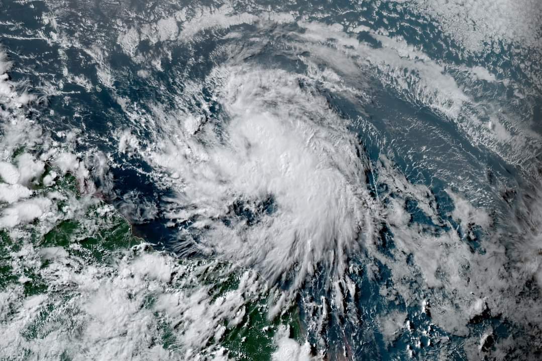
At 5 p.m. AST, the center of Tropical Storm Elsa was located about 410 miles (660 km) east of Barbados. It’s moving toward the west near 28 mph (44 km/h). An even faster motion toward the west-northwest near 29 mph (46 km/h) and this general motion is expected to continue for the next couple of days. On the forecast track, Elsa will pass near or over portions of the Windward Islands or the southern Leeward Islands on Friday, move into the eastern Caribbean Sea late Friday and Friday night, and move near the southern coast of Hispaniola on Saturday. By Sunday, Elsa is forecast to move near Jamaica and portions of eastern Cuba.
Maximum sustained winds are near 45 mph (75 km/h) with higher gusts. Tropical-storm-force winds extend outward up to 90 miles (150 km) mainly to the north of the center. Some strengthening is forecast to occur during the next 48 hours.
A storm surge will raise water levels by as much as 1 to 3 feet above normal tide levels in areas of onshore winds along the southern coast of Hispaniola.
Elsa is expected to produce rainfall totals of 3 to 6 inches with maximum amounts of 10 inches on Friday across the Windward and southern Leeward Islands, including Barbados. This rain may lead to isolated flash flooding and mudslides. Over Puerto Rico, rainfall of 1 to 3 inches with localized amounts of 5 inches is expected Friday into Saturday. This rain may lead to isolated flash flooding and minor river flooding, along with the potential for mudslides. Along portions of southern Hispaniola, rainfall of 4 to 8 inches with isolated maximum amounts of 12 inches is possible on Saturday. This rain may lead to scattered flash flooding and mudslides.
The next complete advisory will be issued at 11 p.m. AST – http://www.hurricanes.gov
